Directory: Random Listings

Xodus Group’s proprietary application makes the analysis and management of maintenance data more transparent, accessible and efficient. Significant savings are a result of completing activities faster using XMAINT’s highly intuitive interface combined with its advanced toolset for creating maintenan ...
Read More ...

This page allows you to search for information on oil and gas fields of Kansas. The searches will return links to all of the data we have for the oil and gas field(s) that match your query.
Tecplot RS Popular
Tecplot RS gives engineers the ability to manage and analyze simulation data, uncover knowledge about reservoir model behavior, and gain confidence in making crucial decisions. Learn more on our website. Benefits include:
Integrated Work Environment
Supports most major reservoir simulators.
Com ...
Read More ...


Solve exploration and production issues with organic geochemistry
Geochemistry can be applied to all phases of a field life cycle: exploration, appraisal, development, production, and abandonment. Malcom interactive fluid characterization software offers geochemical engineering solutions by process ...
Read More ...

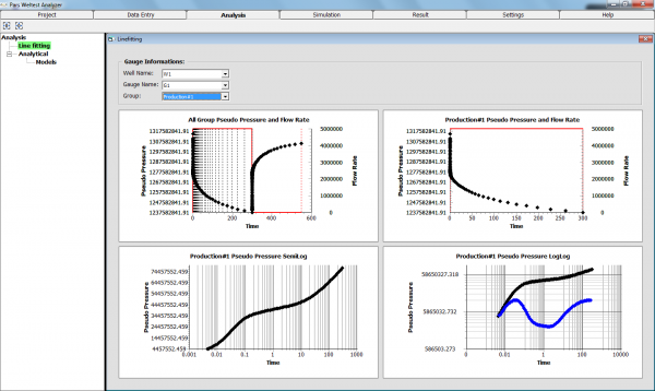
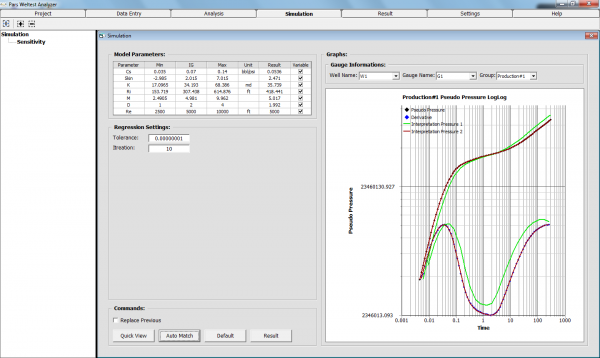
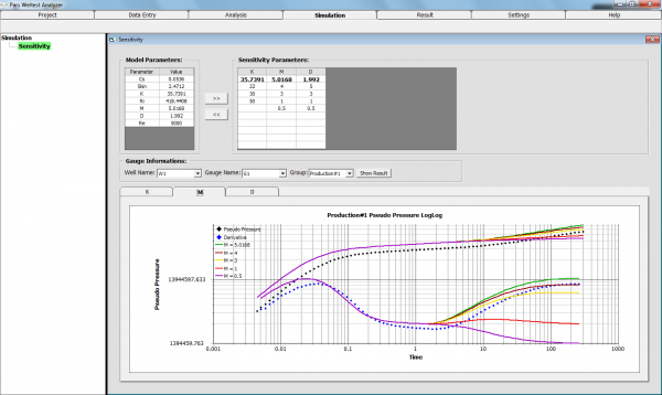
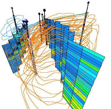
Pars WellTest Analyser (PWA) Popular
Pars Welltest Analyser (PWA) is a comprehensive package for analyzing and history matching transient well test data. The applied analytical methods in PWA and also numerical methods in our future development plan help engineers to interpret reservoir flow characteristics and predict future productio ...
Read More ...

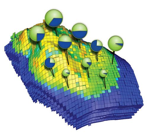
GigaPOWERS™ Popular
The Saudi Aramco EXPEC Advanced Research Center debuted its giga-cell reservoir simulation technology, GigaPOWERS™, Jan. 23 in front of an overflowing audience in the EXPEC Auditorium.
GigaPOWERS™ is the second generation of Saudi Aramco’s leading reservoir simulator, POWERS (Parallel Oil, Water an ...
Read More ...

VFP Pro Popular
Availability of a software for pressure drop prediction of multiphase flow in wells with considering well conditions and accessing to its source code for future development, is one of the main necessities of oil industries in reservoir modeling. MTC tried to satisfy this requirement by developing VF ...
Read More ...

The program will keep track all the mud materials,receipts and transfers The program saves all the data in a background running database
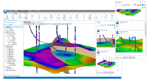
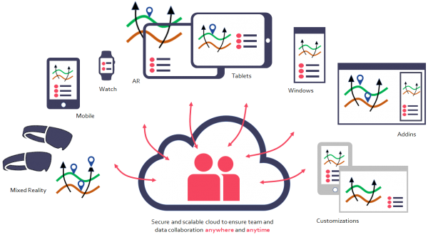
Our BaselineZ environment helps to address two of the biggest challenges faced by Oil & Gas companies: collaboration and information sharing.
Our solution provides connectivity at various levels: in the application, using your mobile devices and even using Mixed Reality and AR devices to visual ...
Read More ...

Reservoir Gas Analysis Software (ResGAS) computes critical pressures and temperatures and specific gravities and heating values of a gas stream. The application works with the Reservoir Solutions Modules program. The computation of gas properties includes corrections for contaminants and adjustments ...
Read More ...
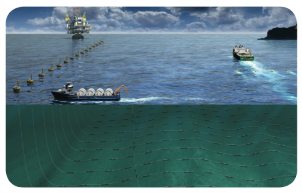
Setting the industry standard for nearly 20 years and with more than 20 licenses globally, the Gator seabed navigation, Command & Control software is designed to meet the unique challenges of distributed, multi-vessel ocean bottom (OBC, OBN), transition zone (TZ), and electromagnetic (EM) data a ...
Read More ...
GVERSE Attributes enables geoscientists to harness the full power of seismic attributes by drastically reducing the time, effort and disk space required for attribute analysis. Fast, on-the-fly computation, and real-time visualization of seismic attributes in a multi-pane viewer or in a 3D environme ...
Read More ...


This specialized set of applications within HampsonRussell improves the signal-to-noise ratio and alignment of CDP gather data in preparation for any prestack analysis process such as AVO or simultaneous inversion.
Improve Gather Data for Pre-Stack Analysis
Gather Conditioning removes noise, provi ...
Read More ...
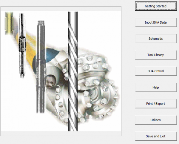
A complete analysis for bottom hole assembly design (BHA Design) Torque and Drag, Harmonics and much more A graphic design and all the critical properties of your BHA
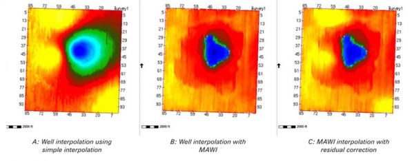
The Multi-Attribute Well Interpolator (MAWI) adds geologically consistent detail to reservoir models by using external trends to drive interpolation of lateral changes beyond well control. This improves reservoir model quality between wells.
Building Better Low Frequency Models
The MAWI analysis a ...
Read More ...

Technology overview
Successfully drilling challenging wells requires an in-depth understanding of the hydraulics during all phases of the operation. The drilling process is highly dynamic and complicated to model; thus, much of the dynamics have traditionally been neglected. However, with diminishi ...
Read More ...
Multi-well Reservoir Simulation Tool ResAna® is a traditional single-phase, arbitrary geometry, variable property, finite-difference simulator used to model well-to-well interaction in the reservoir as that interaction is affected by reservoir and fluid properties and geometry through time.
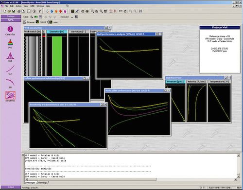
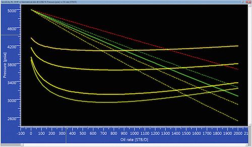
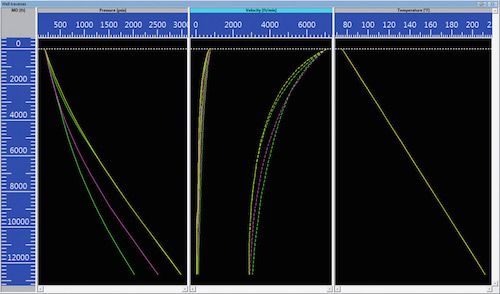
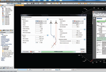
Amethyste is a standalone module dedicated to Well Performance Analysis. It has its technical roots in WAM, a tried and tested WPA program developed and used by Marathon since 1986. It spans the divide between data and datum in Saphir NL, Topaze NL and Rubis and provides a natural extension to resul ...
Read More ...

Single Source for Borehole Data
Vast and expanding quantities of borehole data are acquired over time in disparate formats, distributed, loaded and duplicated repeatedly among different databases. Information may be incomplete, inaccurate or uncertain, and access to critical project data too slow f ...
Read More ...
ArcGIS is a family of software products that form a complete GIS built on industry standards that provide exceptional, yet easy to use, capabilities right out of the box. ArcGIS is a complete, single, integrated system for geographic data creation, management, integration, and analysis.
Much more t ...
Read More ...