Directory: Random Listings


The Petrel Domain Conversion module enables quick generation of velocity models based on different types of velocity data.
The module enables you to build multiple velocity models to test different velocity parameter scenarios and obtain a better understanding of the structural uncertainty. You can ...
Read More ...


The first step to ensure an optimum completion is to remove leftover drilling fluid residue and casing debris. This requires that the drilling mud be changed out with solids-free completion fluids. Completion fluid displacement involves multiple fluids sequenced in circulation. Varying flow rates, f ...
Read More ...
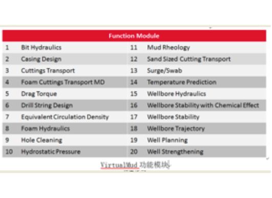
VirtualMud is a software for performing computations of hydraulic in an oil well drilling operations self-developed by COSL which includes Prediction of Temperature, Bit Optimization, Well Strengthening, Wellbore Hydraulic, Torque&Drag, etc. It can accurately calculate the of ECD, ESD and Hole C ...
Read More ...
Simulate field conditions for a safer well test environment
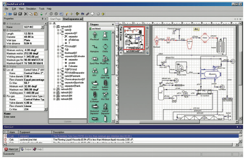
ArchiTest* well test design software provides a realistic steady-state simulation of actual field conditions to facilitate surface well test planning. The main goal of the software is to enhance the safety of the well test environment by i ...
Read More ...
MerlinView3D is a 3D modeling extension of the Merlin Reservoir Simulator that allows users to view the inplace oil and gas in a 3-dimensional representation of the oil and gas reservoir.
A USER-FRIENDLY SOLUTION
MerlinView3D is a result of our informal alliance with creator Sciencesoft—our 3D vis ...
Read More ...
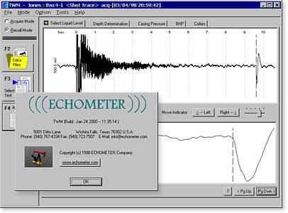
ECHOMETER Total Well Management (TWM)


VOXI Performance Advantages
VOXI provides a solution for large, multi-parameter geophysical inversion modelling that can aid all stages of exploration and is suited for any size of project. It includes advanced inversion techniques that have been proven to increase geophysical model accuracy. On-de ...
Read More ...

This add in App Mud Inventory for DrillPro This add in App is for The latest version of DrillPro only
This is an Excel workbook with a spreadsheet page for each measurement. The spreadsheets are protected so that only the input cells can be changed. The tables that were used to create the workbook are in Chapter 4.
Visualize Data
Eliminate subsurface uncertainty. Achieve insight and clarity by transforming raw, subsurface data into understandable well logs, borehole models, and cross sections/profiles. Easily create professional geotechnical reports that clearly communicate important information with Strater. ...
Read More ...

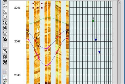
A virtually automatic processing chain with the flexibility to override or optimize parameters, including automatic and manual-repair options to correct acquisition errors.
Features
You can take advantage of processing chains for HDT/OBDT, FMS/FMI/SHDT, UBI/ATS, ARI, HALS, RAB, ADN and Western Atl ...
Read More ...
RokDoc WellTie and RokDoc Advanced WellTie for wavelet estimation
Well-ties form the basis of seismic interpretation and also allow a quantitative analysis of the seismic phase, frequency and other attributes. Good well-ties are essential for quantitative seismic workflows such as inversion and res ...
Read More ...


“Geonaft” is a modular software package intended for comprehensive engineering support for directional and horizontal wells drilling aimed at the most successful bore positioning in a target horizon.
SP “Geonaft” allows determining the well stratigraphic position while drilling as well as to foreca ...
Read More ...
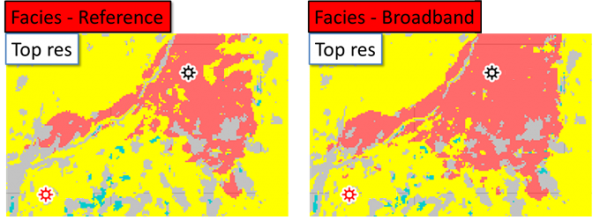
PetroDynamics is distributing software that allows the user to model stratal patterns in tectonic settings such as passive margins, foreland basins, growth faulting, and salt diapirs. Sedimentation processes include: siliciclastic, carbonate and evaporite deposition, diagenesis, and erosion.
The us ...
Read More ...
MicroSeismic’s FracStar Surface Monitoring uses an easily deployed, retrievable, surface-located, radial geophone array to effectively monitor long laterals and pad drilling over large geographic areas. Each array is customized for the operator’s specific area of interest, ensuring the highest quali ...
Read More ...


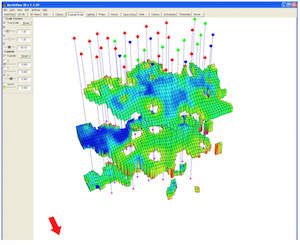
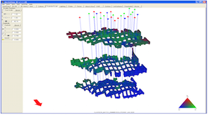
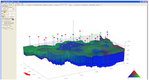
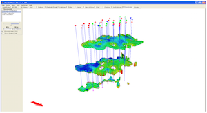
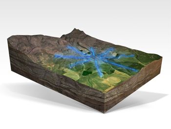
GeoScene3D
GeoScene3D is a 3D Geological modelling software for visualizing geoscience data, building geological models in order to distribute the results to stakeholders. The software is well suited for geoscientists in public and private organizations working with engineering geology, groundwater ...
Read More ...
The world is driven by innovations- this is why CardGio Inc always strives to be one step ahead of the status quo. To push the boundaries of the ordinary and to create something truly brave and unique- is our goal. CardGio Inc is the visionaries, it is the scientists, and it is the programming speci ...
Read More ...
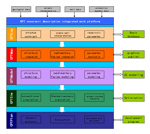
GPT reservoir description integrated work platform ®
During the development later stage, the containing water in the oilfield would be higher. After years of strong injection and forced production, reservoir parameters and fluid distribution have be changed, together with the reservoir heterogeneit ...
Read More ...

Single Version of Primary Well Data
E&P professionals spend considerable time searching for data and trying to determine its origin, evolution, and quality with the greater portion of this time used to determine whether the data is trustworthy. Low quality data can lead to inaccuracy and poor d ...
Read More ...
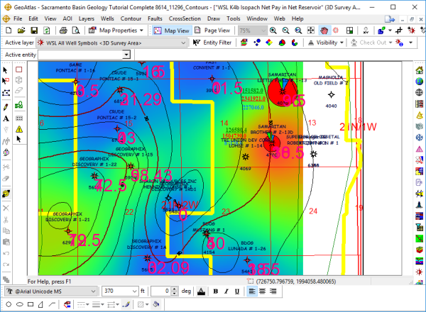
A Powerful Mapping Environment for Professionals
GeoAtlas is a robust mapping environment for GeoGraphix that facilitates displaying, modifying, and arranging map layers created in other GeoGraphix applications. It facilitates designing maps and montages, as well as providing a platform for other a ...
Read More ...