Directory: Random Listings


Gather Displays
Not all changes in seismic amplitude are due to fluid effects, this powerful workflow tool will not only allow interpreters to determine the effects they may see at different angles/offsets in the presence of oil & gas it will also help them to avoid false effects caused by tuni ...
Read More ...
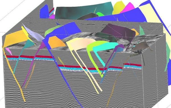
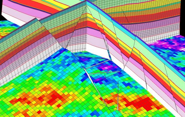
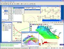
SKUA-GOCAD Popular
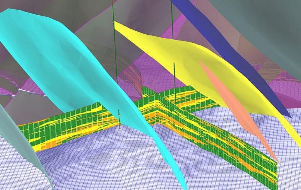
Better field development through true collaboration and geological integrity. FROM SIMPLE TO COMPLEX: 20 YEARS OF HIGH-QUALITY SUBSURFACE MODELING Paradigm® GOCAD® has led the industry for over 20 years in providing the most advanced capabilities for seismic, geological and reservoir modeling. In 20 ...
Read More ...
Pdyke is an enhanced version that also calculates the effect of a dipping 2-D prism.
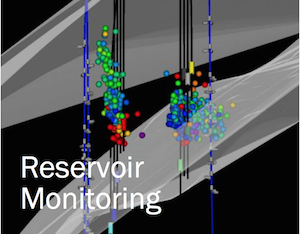

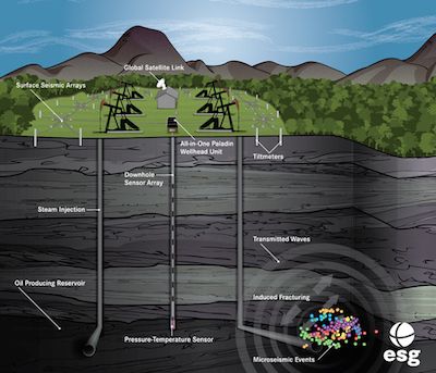
ESG’s RESMAP® service successfully delivers continuous, real-time feedback on reservoir conditions in response to injections. Monitor EOR operations, ensure caprock and well casing integrity, track steam chamber growth, evaluate fault activation and assess induced seismic hazard. Microseismic monito ...
Read More ...
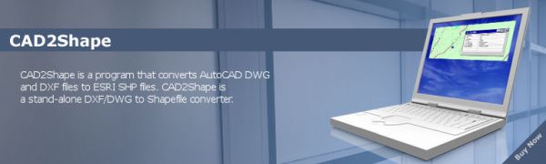
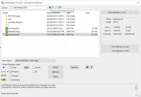
Convert AutoCAD DWG / DXF to ESRI Shape (.shp) CAD2Shape is a dwg and dxf converter that converts AutoCAD DWG and DXF files to ESRI SHP (shapefile) files.
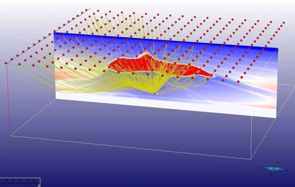
Determining the uncertainty inherent in reservoir property estimation is a key requirement for the risk assessment of an existing asset. PGS uses a state-of-the-art Bayesian inversion which directly inverts reservoir properties in the depth-domain. This, coupled with depth dependent rock physics, pr ...
Read More ...

TRACESEIS’ ROCK PHYSICS PACKAGE
Tool to analyze the relationship that rock properties (Vp, Vs, density and derived properties) have with reservoir properties (porosity, lithology and fluids). The analysis and modeling packages (SeisRP and SeisMod) lead to the reservoir characterization module (Seis ...
Read More ...
Drive continuous improvement across your entire well construction activity
RigHour* drilling operation efficiency analysis delivers an accurate understanding of drilling operation performance across single and multiple wells by computing and comparing drilling-specific KPIs. Drilling organizations ...
Read More ...
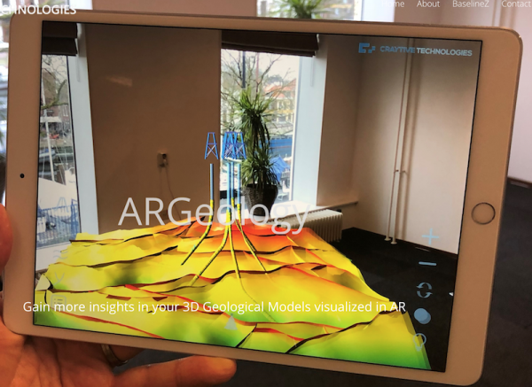
Our ARGeology iPad and iPhone apps enables you to visualize your 3D Geological Models in your own environment. This way of visualization enables you to explore your 3D model in a way that you have never seen before!
In ARGeology we are able to visualize many different data models and object types, ...
Read More ...
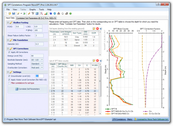
NovoSPT is a unique geotechnical software designed for correlating SPT blow counts (N) to various soil properties using 300+ correlations.
Key Features:
Estimation of 30 soil parameters including friction angle Ø, cohesion C, CBR, relative density Dr, undrained shear strength Su, modulus of elas ...
Read More ...
Roxar Tempest MORE Popular
Tempest MORE is a modern full field, full physics next generation simulator. Optimised for large models, and providing parallel simulation as standard, engineers benefit from fast simulation. Deck setup is simplified by support for standard grid formats, table input for well historical, trajectory a ...
Read More ...
Drilling operations are increasingly more complex and geographically diverse when pursuing the most promising opportunities.
The iWellFile operations view gives team members and management fast, secure, and simple access to operations information from both ongoing operations and historical wells. ...
Read More ...


Pipe-It is a unique software application that allows you to graphically and computationally integrate models and optimize petroleum assets.
Pipe-It can launch any software application you are currently running, on any operating system. Pipe-It chains together your applications, in series and in par ...
Read More ...


Drawing on over 30-years in-field experience and with over 50 installations on vessels worldwide, Orca is the industry leading system that centralizes and automates the Command & Control of all on-board and in-water systems. Orca delivers efficiency improvements in today’s acquisition environmen ...
Read More ...
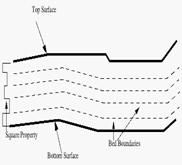
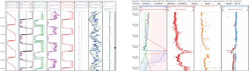
Seismic Log-Propagated Property (SeisLog) Slice (seisSuperMan) A function designed to slice log-propagated property (SeisLog). The sliced-SeisLog is stratigraphic property and also shares the same geometry as seismic, which geometry is irregular. The irregular sliced SeisLog property (IRS-SeisLog) w ...
Read More ...
IMprove Popular
IMprove™ is the software application developed by Intelligent Solutions, Inc. for "Intelligent Production Optimization - IPO". IMprove™ provides a comprehensive workflow for the development of Intelligent Well Models. "Intelligent Production Optimization - IPO" is part of a new class E&P product ...
Read More ...

Echelon is the fastest reservoir simulator in the world. It typically achieves between 10x – 50x faster runtimes than the leading commercial offerings while retaining the accuracy you expect from legacy simulators. Furthermore, Echelon has demonstrated scaling to very large systems with 100’s of mil ...
Read More ...
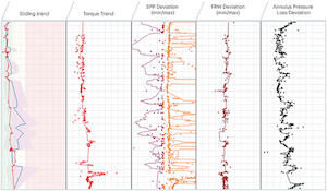
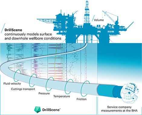

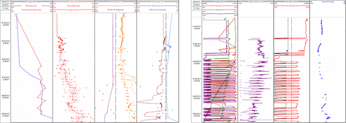
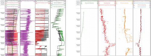
DrillScene is an advanced software tool for monitoring and trend analysis during drilling operations. It creates a dynamic, real-time picture of the entire wellbore with changes between the model and reality visualized as trends graphs. This helps drilling analysts and engineers to optimize operatio ...
Read More ...


GPTLog Fine geological interpretation and correlation software
GPTLog is used for well logging interpretation and geological interpretation for the oilfiled geological staff. Human-computer interaction can be used for logging data pretreatment, logging curves standardization, logging parameter inte ...
Read More ...


Do you struggle to determine the optimal set of operating conditions to achieve the highest conversion while still making a stable fuel oil product? How do you manage the performance of your furnace? Do you have concerns with regards to furnace fouling? Are you trying to increase your furnace run le ...
Read More ...