Directory: Random Listings


A suite of easy to use, Excel based software applications for Field Development Planning.
Palantir’s Field Development Planning Suite is a set of Excel based software applications that allow Planners to understand the various scenario and development options available to their portfolio of assets. ...
Read More ...

PetroMod petroleum systems modeling software combines seismic, well, and geological information to model the evolution of a sedimentary basin. The software predicts if, and how, a reservoir has been charged with hydrocarbons, including the source and timing of hydrocarbon generation, migration route ...
Read More ...
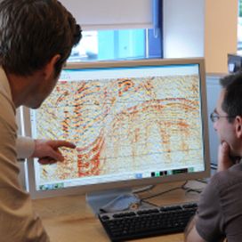
RokDoc RT - software for real-time well monitoring and risk management
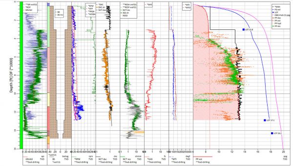
RokDoc RT is Ikon's real-time pore pressure prediction software. Any pore pressure prognosis inherently involves uncertainty: Offset well data uncertainty, seismic data uncertainty and geological uncertainty. Estimating and pred ...
Read More ...
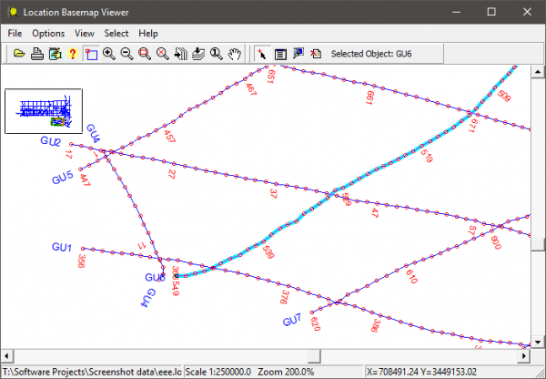
Lynx Baseview is a free viewer for seismic location data (seismic basemaps) in Lynx LOC and ESRI shapefile formats.
Baseview gives you control over shotpoint annotation and initial scale, and allows you to quickly zoom and pan your basemap. Baseview also provides QC plotting to Windows printers.
B ...
Read More ...
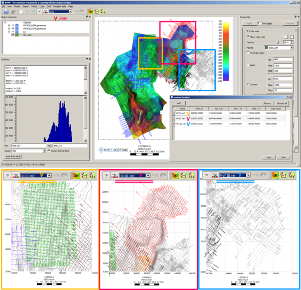
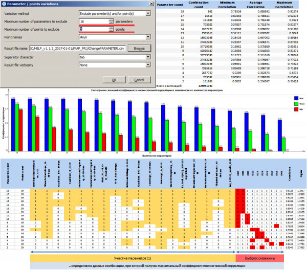
IngeosMAP (iMAP)® is the first product in the special-purpose software, and allows to fully solve a wide range of problems related to technologies of G&G data mapping, prediction and integration.
Ten advantages of the IngeosMAP software (iMAP):
Complete cycle technology to work with 2D geolo ...
Read More ...


Introduction
In 1996, the Indiana Geological Survey published for the Illinois Basin Consortium a Corebook of Pennsylvanian Rocks in the Illinois Basin (IBC Studies 3). This full-color book illustrates common lithologies found in coal-bearing rocks of the Illinois Basin and provides a standard term ...
Read More ...


Waterdrive is a collection of classical Waterdrive calculations and routines intended for Petroleum Reservoir Engineers to :
Analyse the water-oil displacement processes for both homogeneous single layer and heterogeneous multi-layered systems, and permit the calculation of waterflood performanc ...
Read More ...
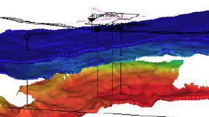
Seismic data conditioning, using a Reservoir Oriented Processing (ResOP) workflow, is a key improvement for any quantitative seismic interpretation or reservoir characterization project using pre-stack seismic inversion technology. A tailored processing sequence is applied to remove noise and enhanc ...
Read More ...


Gascap Drive Index Material Balance Solver is developed primarily to offer assistance to petroleum engineers, reservoir engineers, researchers, petroleum production engineers, drilling engineers, completion engineers, petrophysicists, petroleum geologists, students (undergraduates, postgraduates, et ...
Read More ...
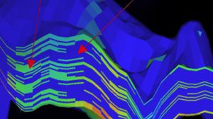
Not all attributes are born equal. The comprehensive Paradigm® collection of traditional and innovative seismic attributes provides tremendous subsurface imaging power by improving the seismic response to specific subsurface or reservoir conditions. Seismic attributes provide the seismic interpreter ...
Read More ...


This software works under Windows® 32 and 64 bits It takes benefit of its display qualities, uses all the peripherals for printing and allows the transfer of the graphs by copy-and-paste and as metafiles. The use of the software is easy and intuitive. The measured values and the spread geometry can ...
Read More ...


The EM-Q application was developed in collaboration with Fugro Airborne Surveys (now the Airborne Surveys Division of CGG). It provides a simple and quick way of using moments of the impulse response to interpret a transient electromagnetic (TEM) anomaly. Two types of model are available:
A simpl ...
Read More ...
This is a File Auditing, Management and Model Version Control Tool
The Model Catalogue is designed to allow the engineer to have a structured archiving system to store and retrieve IPM and field model data files. The engineers can thus maintain a complete history of each version of a model as it is ...
Read More ...

Too often data lies underutilized in databases and expert systems or is difficult to harness due to its size or file format. Unused data has the potential to unlock billions in savings, new market opportunities and speed up decarbonisation.
With Field Twin your teams have access to the right inform ...
Read More ...
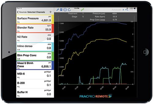


FRACPRO REMOTE real-time fracture operations monitoring app The FRACPRO REMOTE app is for Apple® iOS devices and allows anyone, anywhere, to connect to the frac job in real-time. The application links FRACPRO software on location to the mobile device over the internet using a unique IP address.
Geovation has evolved from over 40 years of expertise in geophysical software and incorporates the latest technology from the recognized leaders in advanced processing and imaging. Geovation is the powerhouse behind CGG market-leading geophysical services.
Benchmark Software for Seismic Data Proces ...
Read More ...
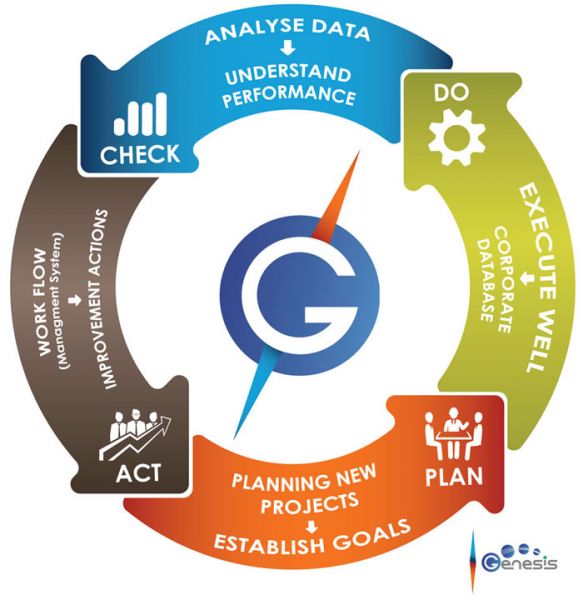
Genesis Planning and Follow Up (PFU) is a comprehensive software tool for planning and following-up the execution of drilling, completions and workover activities. It produces an optimized forecast of the time and cost of future interventions.
How will your company benefit?
Optimized forecast of ...
Read More ...


Move Core Application
Move is the core application of the Move suite. It provides a powerful stand-alone environment for data integration, cross-section construction and 3D model building, and forms the base for the specialist structural modules for 2D and 3D Kinematic Modelling, Geomechanical Mode ...
Read More ...
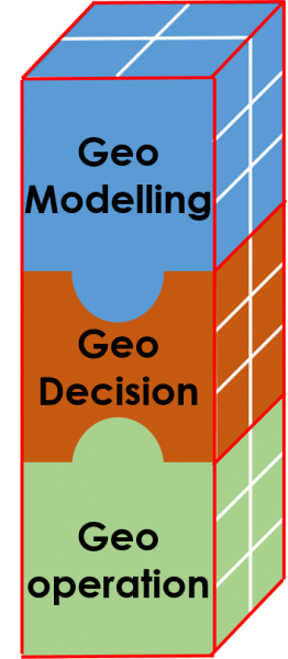
GeomodL Geomodelling tool kit for Petrel is currently under brainstorming phase Stay tuned !
Visualize Data
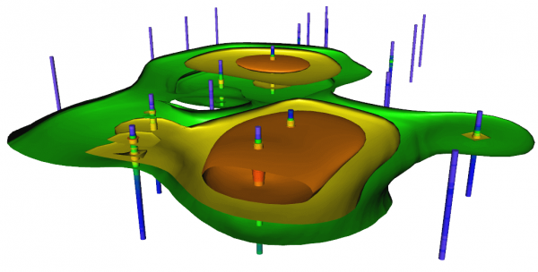
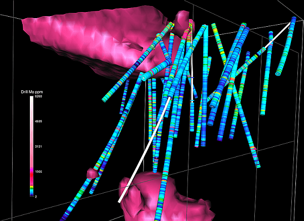
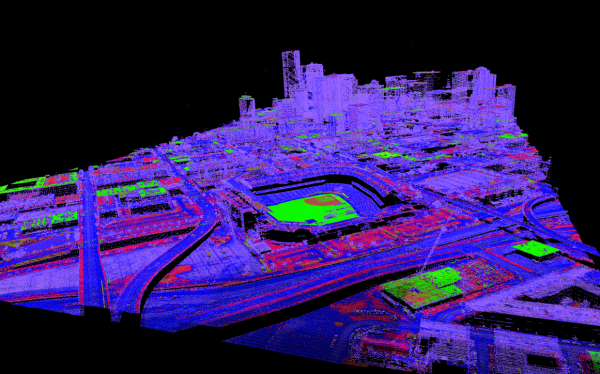
Model data with striking clarity in every dimension. With Voxler’s extensive 3D modeling tools, it is easy to visualize multi-component data for geologic and geophysical models, contamination plumes, LiDAR point cloud, borehole models, or ore body deposit models. Distinguish areas of ...
Read More ...