GeoSciML and GeoSciML-Portrayal
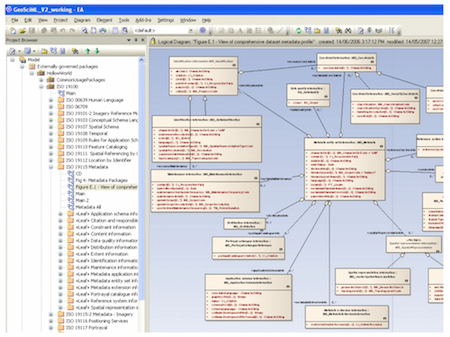
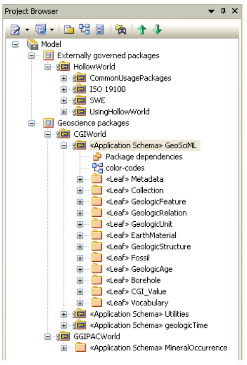
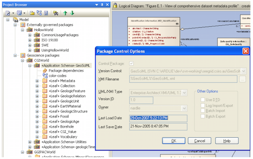
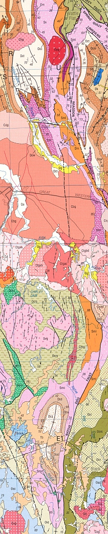
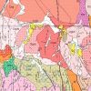
GeoSciML or Geoscience Markup Language is a GML Application Schema that can be used to transfer information about geology, with an emphasis on the "interpreted geology" that is conventionally portrayed on geologic maps. Its feature-type catalogue includes Geologic Unit, Mapped Feature, Earth Material, Geologic Structure, and specializations of these, as well as Borehole and other observational artefacts. It was created by, and is governed by, the Commission for the Management and Application of Geoscience Information (CGI) to support interoperability of information served from Geologic Surveys and other data custodians. It will be used in the OneGeology project, an effort to create a geological map of the entire Earth, served live by merging data from many national geological surveys.
Rating
Visits
922
Redirects
285
Don't Miss Out! Get the Best Deal on this Software - Email Us Now!