Geoscience Software
Geoscience is the branch of science dealing with planet earth, including features on the earth’s surface, and below it. In petroleum industry, geoscientists play an important role in finding underground oil and gas reservoirs. They are also involved in mapping and interpreting underground surface interpretation. Today there are a number of advance geophysical software packages available for processing, interpreting and running inversion on reservoir seismic data.


Acceleware has developed AxWAVE™, a high performance finite-difference seismic forward modelling solution used for the simulation of seismic wave propagation through the subsurface. This application enables a fast and accurate simulation of 2D and 3D seismic energy in an acoustic medium. AxWAVE uses ...
Read More ...
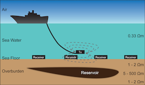
The marine controlled source electromagnetic (CSEM) method is a low-frequency electromagnetic imaging technique aimed at generating the electric resistivity map of seafloors. In a CSEM survey, an electromagnetic transmitter and arrays of electromagnetic (EM) receivers are used to probe the subsurfac ...
Read More ...


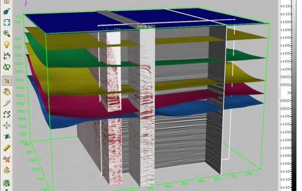
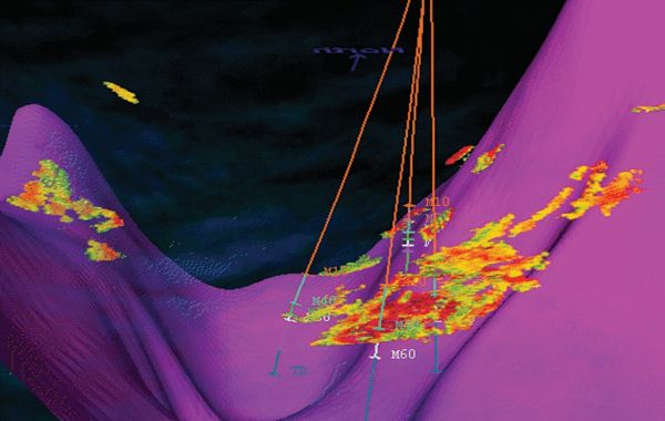
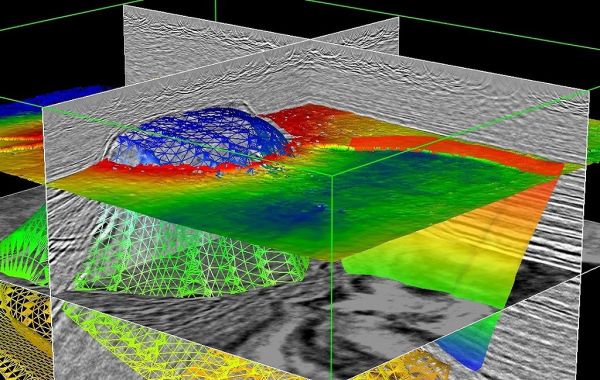
A full 360 degrees of insight into subsurface exploration and production. Imagine lowering a camera into the earth’s subsurface and recording a continuous animation that captures the surroundings in all directions and angles. The dream is now a reality. The Paradigm® EarthStudy 360® full-azimuth ang ...
Read More ...


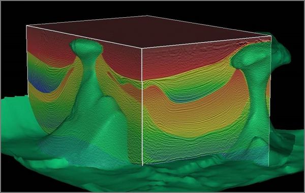
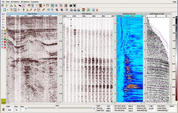
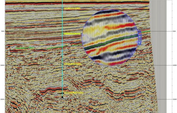
The industry’s leading system for seismic processing. For over 25 years, Paradigm® Echos® has been the oil and gas E&P industry’s leading system for seismic processing. Its popularity is based on its breadth of geophysical applications, its unique combination of production and interactive seismi ...
Read More ...


Fast time-to-depth conversion in any geological environment. Paradigm® Explorer™ is a comprehensive time-to-depth conversion, velocity modeling and quality control solution. With unprecedented levels of interactivity and visualization, Explorer performs fast and accurate time-to-depth conversion in ...
Read More ...
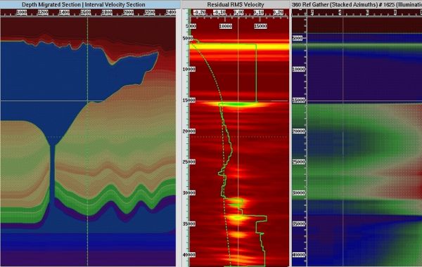
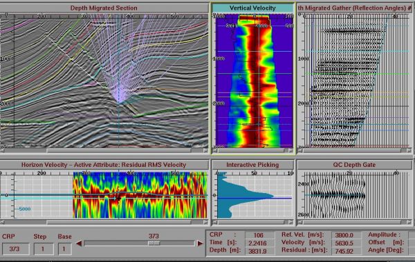
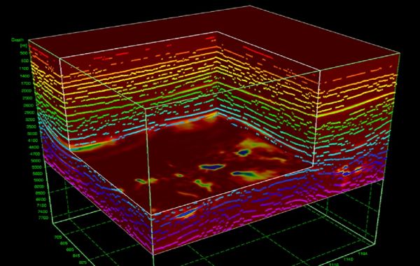
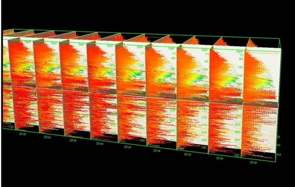
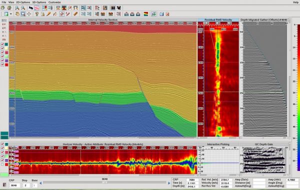
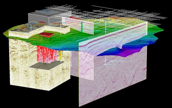
Reduce drilling risk through advanced velocity determination, modeling, and imaging. Explorationists rely on the Paradigm® GeoDepth® velocity determination and 3D/2D velocity model building system to create accurate seismic imaging in either time or depth. Through the integration of interpretation, ...
Read More ...


Paradigm® offers a full range of 3D prestack and poststack time and depth migration methods, aimed at supporting a wide range of imaging objectives. The migrations, supported by the Paradigm GeoDepth velocity model building solution, include: Kirchhoff migration
Kirchhoff: Fast, flexible and targ ...
Read More ...
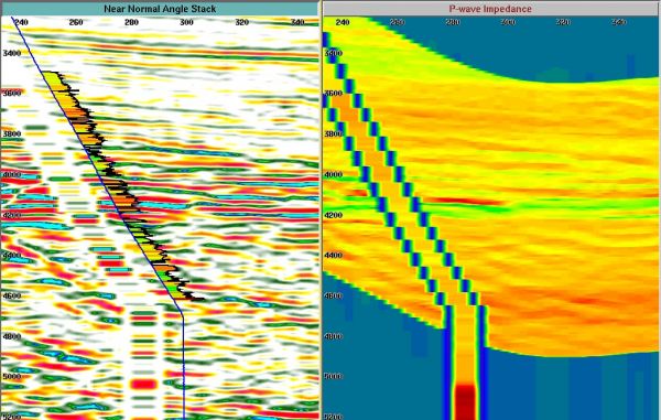
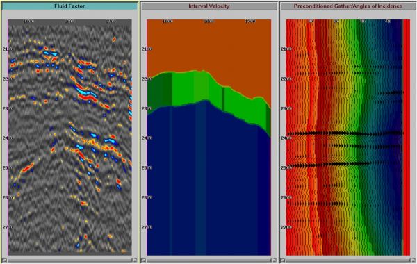
Confident AVO analysis for interpreters and experts alike. The Paradigm® Probe® AVO Analysis and Interpretation system is the ideal solution for both interpreters and experts in AVO analysis and reservoir characterization. By integrating AVO into the interpretation workflow, Probe adds information a ...
Read More ...
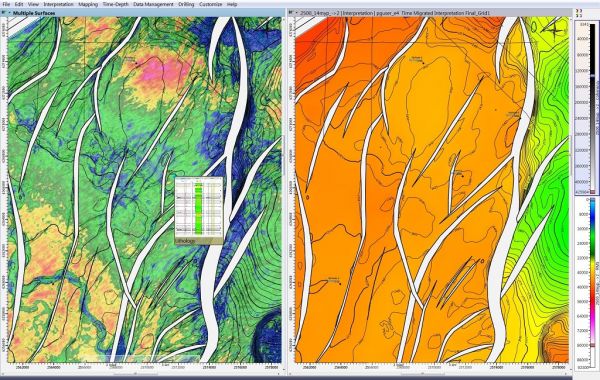
Because your interpretation shouldn't be compromised. Paradigm® SeisEarth® is a comprehensive yet flexible seismic interpretation and visualization system. This innovative multi-survey solution allows interpreters to perform structural and stratigraphic interpretation across many different vintages ...
Read More ...

Multi-attribute seismic classification. Numerous attributes are derived from modern seismic datasets, to provide insight into reservoir properties. Paradigm® SeisFacies®, an extension of the Paradigm Stratimagic® solution, and an integrated component of the Paradigm interpretation and characterizati ...
Read More ...