Geoscience Software
Geoscience is the branch of science dealing with planet earth, including features on the earth’s surface, and below it. In petroleum industry, geoscientists play an important role in finding underground oil and gas reservoirs. They are also involved in mapping and interpreting underground surface interpretation. Today there are a number of advance geophysical software packages available for processing, interpreting and running inversion on reservoir seismic data.


Accurately Tie Well Control to Seismic Data
LogM™ advanced synthetics software is the industry standard for seismic synthetic generation. It provides geoscientists with all the tools necessary to accurately tie well control to seismic data. Users can quickly link geological and seismic data and the ...
Read More ...


Powerful seismic interpretation for your play
The LogM™ modeling package is an add-on to the Advanced Synthetic Package and includes industry-standard stratigraphic modeling and structural modeling. Stratigraphic models are easily generated from the cross-section view and include the formation corr ...
Read More ...
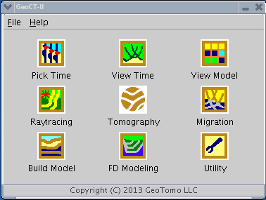
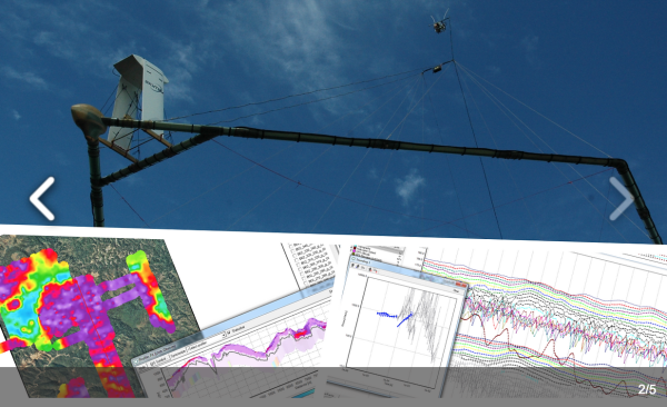
GeoCT-I is a fully automated refraction traveltime tomography application for Windows. It presents a new way to image the Earth. After you activate the software, point the program to the folder where the data will be recorded. As each new shot is recorded, the program will automatically load it and ...
Read More ...
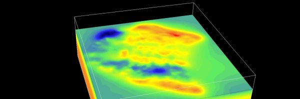
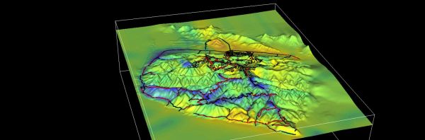
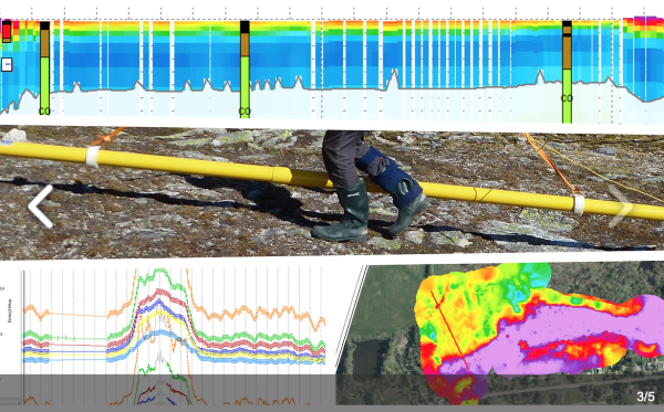
GeoCT-II is a 2D seismic modeling and imaging software package designed for geophysical engineering applications. It includes an advanced model builder, finite-difference full wavefield calculation for acoustic, elastic, and anisotropic media, raytracing and tomography for refraction, reflection, cr ...
Read More ...

Professional software solutions for processing, inversion and visualization of geophysical data.
Aarhus GeoSoftware develops processing, inversion and visualization software for ground based and airborne EM data and ERT/IP data.
Software packages:
Aarhus SPIA: For groundbased single TEM and VES s ...
Read More ...
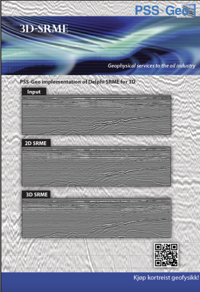
Our developers are mainly doing hard-core C and FORTRAN coding, to solve small tasks we cannot solve directly with Promax/SeisSpace or other commercial software. Then, we combine them with Promax modules to solve the specific tasks.
Here, we suggest to learn about some of our seismic processing m ...
Read More ...
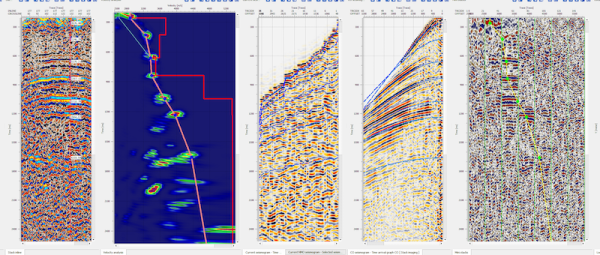

g-Platform™ – seismic data processing software
Geomage g-Platform™ is the most innovative, interactive and advanced software for processing and imaging seismic data of any type and format. The software based on latest developments in software and hardware technologies, can run Windows or Linux and ...
Read More ...
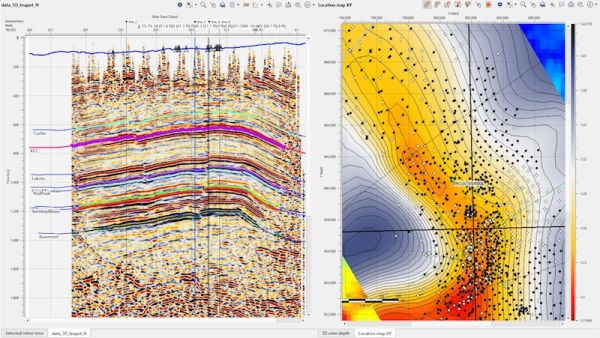
Seismic Interpretation Software
Dynamic synchronization between all views
Horizon picking and management
Simultaneous horizons interpretation on 2D, 3D or arbitrary line view
Interactive picking in time or depth domains
Import/export horizons in ASCII and some other formats
Horizon map creat ...
Read More ...
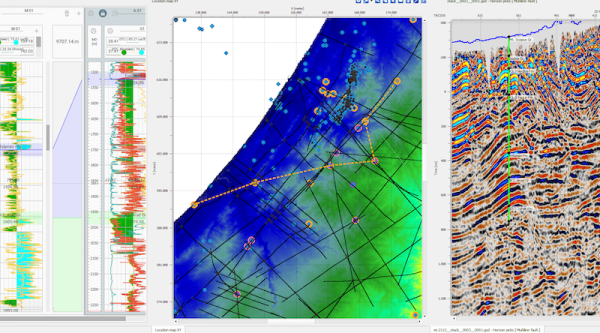
Interactive location map
Allows to visualize multiple data coordinates on interactive location map
Features related to visualization of multiple dataset locations available only in commercial version. The view includes following options:
Interactive selection of seismic dataset
Plotting all so ...
Read More ...
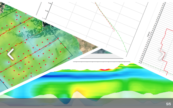
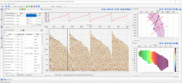
Well data are uploaded into GeoInversion
Data including well logs(LIS/LAS/ASCII), well trajectory, well markers, stratigraphic tops, well evaluation results, such as oil/gas/water zones and sand thickness
Both time domain and depth domain logs can be listed and cross plotted
Time-Depth relation ...
Read More ...