GPTLog
GPTLog Fine geological interpretation and correlation software
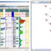
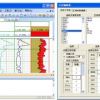
GPTLog is used for well logging interpretation and geological interpretation for the oilfiled geological staff. Human-computer interaction can be used for logging data pretreatment, logging curves standardization, logging parameter interpretation, stratigraphic classification, sedimentary unit and facies identification , breakpoints interpretation, sandstone interpretation, connecting explanation and other fine geological research. It also provides a lot of application tools , such as the completion geological design, perforation program, the calculation of water flooding and so on. The main aim of GPTLog is to provide efficient, flexible and convenient professional tools for the oilfield geological people, unify the workflow, improve the underlying database. Its core technology is adopted wavelet analysis and fuzzy logic, neural network and genetic algorithm, can automatically do the layer partition, sub-layers connected and contrast, and the facies discrimination.
Main feature:
- Flexible data processing
GPTLog provides a lot of flexible data processing functions, such as field calculator, logging curves statistical calculation, discrete data transform. The built-in scripting can help user to complete various data processing.
- Professional logging interpretation tools
The software provides a series of specialized tools, including logging stitching, smooth, joining logging curves, resampling, square-wave, abnormal data processing, interactive editing, depth correction, environment correction, cross plot analysis, etc. Also it provides the convenience logging interpretation work environment, can interactive achieve lithology, reservoir parameter, oil and water layer identification and interpretation though the procedures and parameter calculator in the system.
- Automatic interpretation and interactive interpretation
During the logging interpretation and geological interpretation process, GPTLog provides many automatic interpretation functions, such as wavelet analysis, fuzzy logic, neural network and genetic algorithm, etc. Also you can do this work manually.
- Unified workflow
Under the management of the data server, you can effectively complete the data upload and download, also collaboratively achieve well logging interpretation, contrast layered, sandstone explanation, effective division, less dissection, contrast connectivity, micro-phase identification, parameter interpretation, etc.
- Automatically contrast to identify the facies
Using many advanced methods such as wavelet analysis, fuzzy logic, neural network and genetic algorithm to complete stratigraphy contract and automatically indentify the facies.
- Application


